Two months ago I took a trip up to the demilitarized zone (DMZ), a 250 kilometer (160 miles) long, and about 4 kilometer (2.5 miles) wide stretch of land which separates North from South Korea. The DMZ was created by agreement between North Korea, China and the United Nations in 1953 following the Korean War. In actuality, the war isn’t over; it is currently sitting in a cease-fire status. There are few places I have visited which scared me. This one tops the list.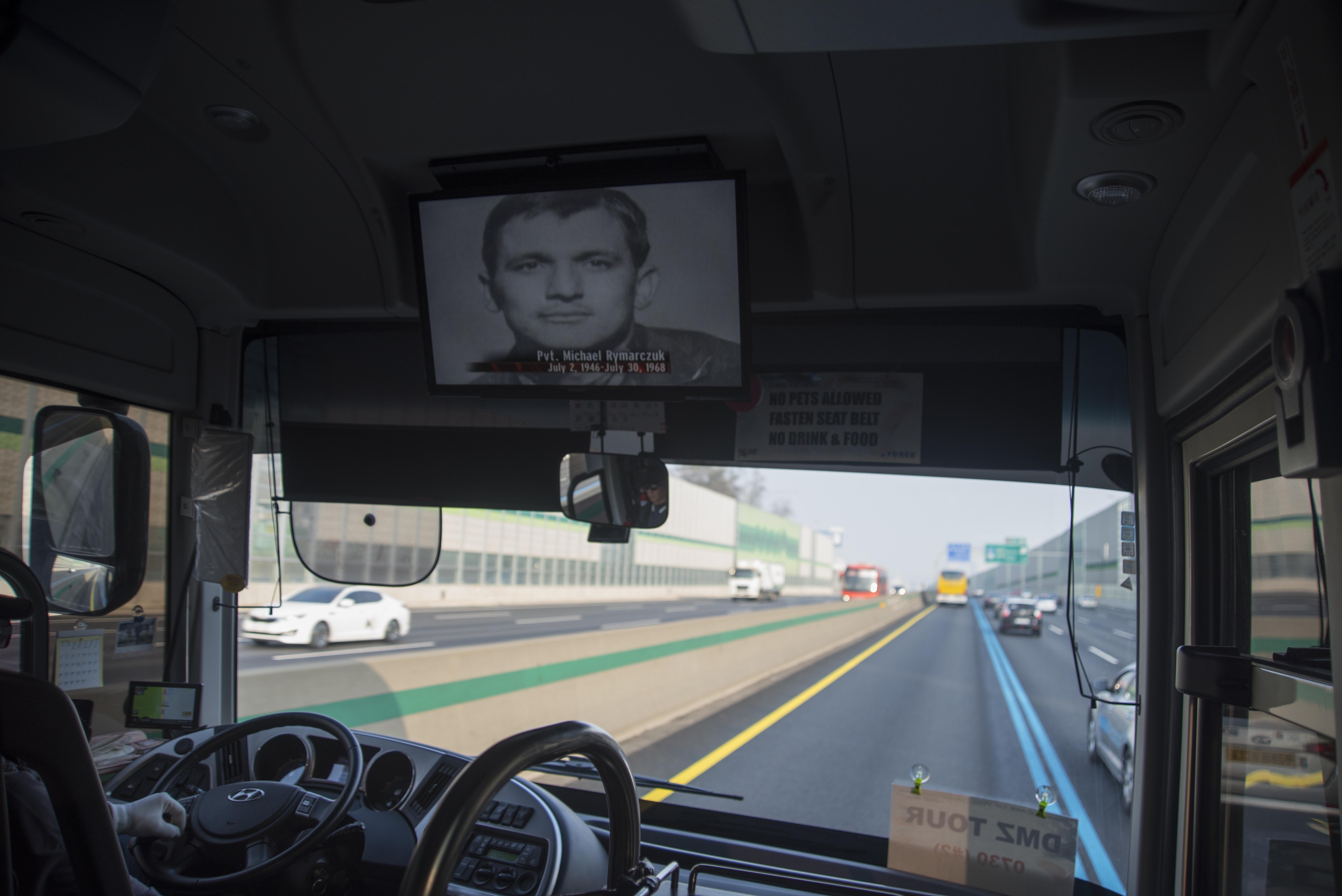
The tour begins on the bus ride up. Passengers watch a video which details the history of the DMZ. The Korean War is a part of this history, and the movie touches on that, but mostly it outlines how the line was drawn and what has happened there since. The movie was very enlightening and as I watched I wondered why in the world I was going to visit such a dangerous place, history buff or not.
Our first stop was at Freedom Bridge. A plaque there reads:
Freedom Bridge…used to be the only passage connecting the south and north sides of the Imjingang River. Originally, there were two railroad bridges on the Gyeongui Line (one for each direction), but they were bombarded, leaving only the piers intact. However, the railroad bridge was restored on the remaining western piers in order to transport Prisons of War over the river, while at the southern end, a temporary bridge was built. …In 1953, when 12,773 South Korean and UN soldiers, taken as POWs by the communist North Korean forces, were returned to freedom, the bridge was named as Freedom Bridge.

 Here is a photo of a bullet riddled steam locomotive which was derailed by bombs during the Korean War. More than 1,020 bullet holes in the locomotive and its bent wheels show the cruelty of the time.
There are many cameras and watch towers in the area.


All along the drive there are bridges meant to be easily destroyed by explosives should South Korea be invaded by North Korea. The large blocks are bricks which would fall and block the roads if there were an invasion.


The second stop is at Dorasan Station, the northernmost stop on South Korea’s Gyeongui Line. Since it is the northernmost part of South Korea, Dorasan Station will also play the role of customs and immigration for visitors entering South Korea through the station when (if) the Gyeongui Line Railroad connection to the North is completed. You can tell by the murals on the train that the hope for unification is of great importance to South Koreans.


There is a piece of the Berlin Wall here. This is very fitting, considering the fact that the Berlin Wall also separated a nation into two halves, tearing apart families for decades. A South Korean soldier patrolling Dorasan Station.
  We were then escorted to Panmunjeom. Panmunjeom was established as the venue for dialogues between South and North Korea in accordance with the armistice agreement signed on July 27, 1953. It is known world-wide as the place where the military armistice conference was held.
 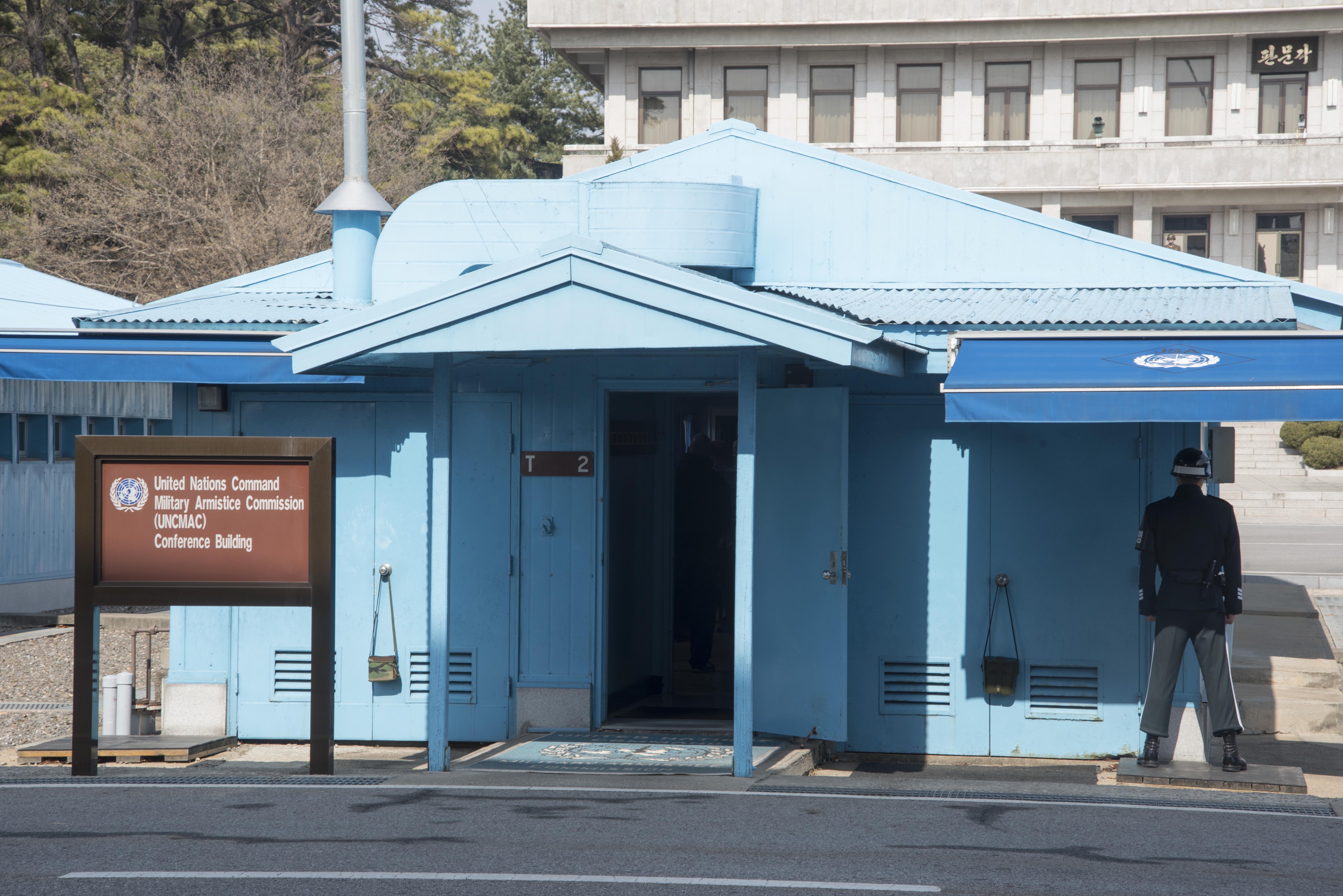 A South Korean soldier guarding the main conference building. They were sunglasses as a method of intimidation.
 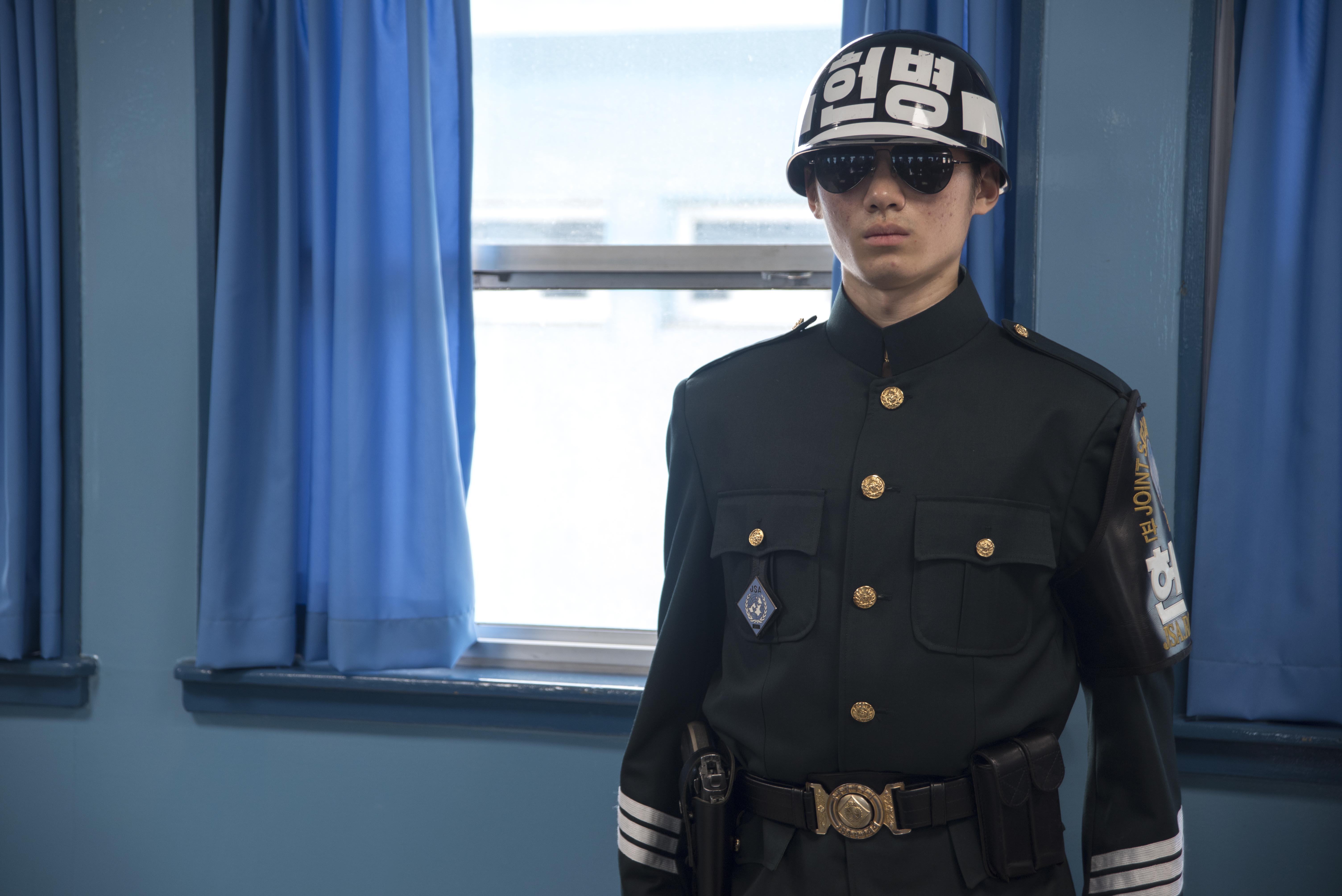 THE table where North and South Koreans hold meetings.


Standing out in the open with a large tour group, North Korea watching, I very much felt like a sitting duck about to be killed by a hidden North Korean sniper, causing an international incident. At the time I thought myself very foolish to have come. Looking back, I’m glad I went.
Following the Panmunjeom visit, our American soldier playing tour guide for the day took us to an overlook where we could peer into the lands of North Korea.


This is a photo of North Korea’s Kijong-dong or “Propaganda Town,” believed to be a decoy town for luring South Korean defectors. The buildings are actually concrete shells with no glass in their windows, electric lights operate on an automatic timer, and the only people in sight are maintenance workers who sweep the streets to give the impression of activity. In the 1980s, the South Korean government built a 321.5-foot-tall flagpole in the opposite city of Daeseong-dong to antagonize the north. This was quickly countered by North Korea, which built a 525-foot-tall flagpole in response. It was at the time the tallest flag pole in the world; the flag itself weighs hundreds of pounds. This is a photo of the Bridge of No Return. The bridge crosses the middle of the buffer zone and it is used to serve as the only entrance to the South from the city of Kaesong in the North. Right after the Korean Armistice Agreement was signed in 1953, POW exchange was made on this bridge. And this was when it was named Bridge of No Return because once POWs decided which direction they would want to go on this bridge, there was no turning back.
The bridge hasn’t been used by either side since the ‘Axe Murder Incident’ of August 18, 1976 when Captain Bonifas and First Lieutenant Barrett were killed by the North during a routine tree trimming (Operation Paul Bunyan). In the below photo you can see an empty spot where a tree once stood. The tree was blocking South Korean soldiers’ view of the bridge. During the trimming of the tree Captain Bonifas and First Lieutenant Barrett were killed even though the North had agreed to the trimming. The murders are known as the most brutal since the DMZ was created.


Here are some additional photos that were taken during the attack.


This is an up close shot of the Bridge of No Return, taken from the window of our tour bus. We were NOT allowed out.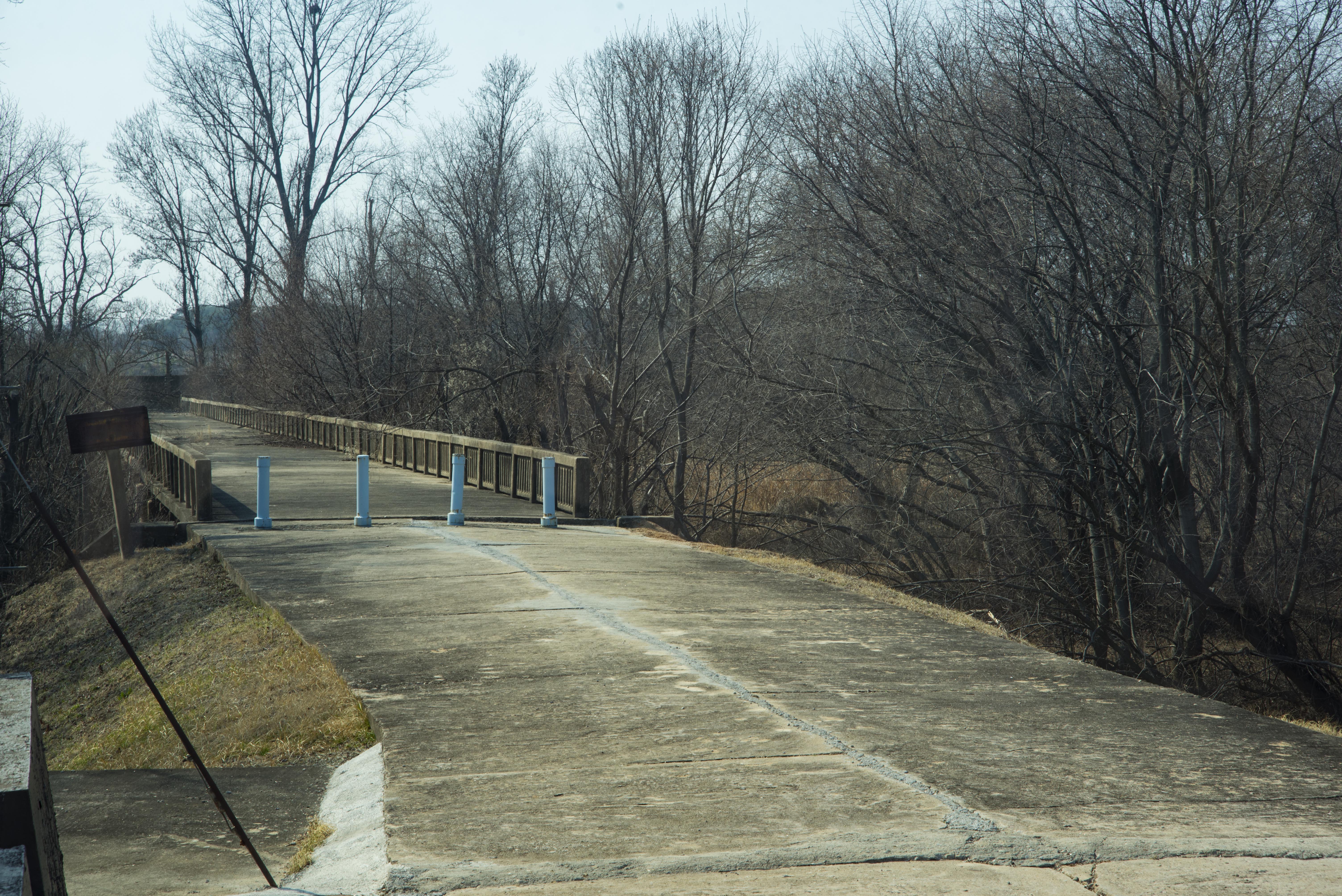 If you are daring, this is a tour that you should take. History is real, and very scary at times.

